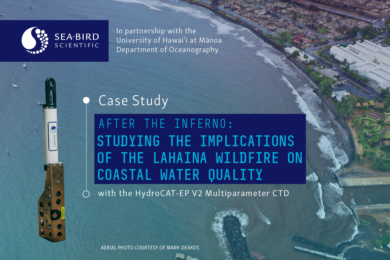
Case Study: Understanding the Implications of the Lahaina Wildfire on Coastal Water Quality with the HydroCAT-EP V2
 Contributors: Dr. Andrea Kealoha (she/her)¹, Natalie Zielinski (she/her)², Marialena Christopoulou (she/her)² Authors: Lindsey Biondo (she/her)², Natalie Zielinski (she/her)²
¹ University of Hawai’i at Mānoa, Department of Oceanography, 1000 Pope Road, Honolulu, HI 96822 USA
² Sea-Bird Scientific, 13431 NE 20th St, Bellevue, WA 98005 USA
Great thanks to Dr. Andrea Kealoha and the team at the University of Hawai’i at Mānoa, for your partnership and for enabling us to highlight your data to better protect our oceans.
Summary
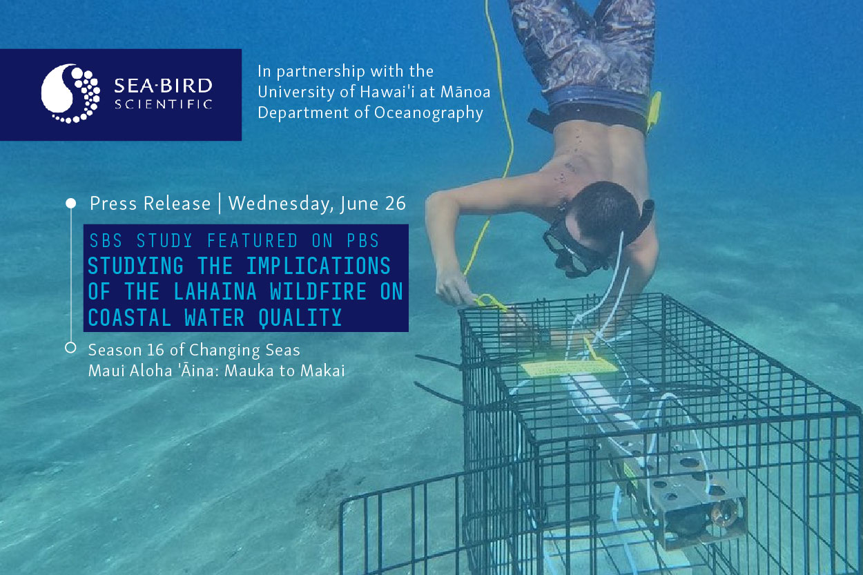
This case study was developed in partnership with Dr. Andrea Kealoha, Assistant Professor at the University of Hawaii Department of Oceanography, along with Dr. Craig Nelson, Dr. Nick Hawco, and Dr. Eileen Nalley. Sea-Bird Scientific loaned a HydroCAT-EP V2 CTD to Dr. Kealoha and her team to monitor coastal water quality off Lahaina, Maui, after the devastating fire on August 8th, 2023. Of interest was understanding the impact of terrestrial runoff on the biogeochemical and oceanographic parameters at the Kahoma stream mouth, a major runoff outlet in Mala Wharf. The deployment took place over roughly 3 months from November 12th of 2023 to February 1st of 2024.
Instruments used in this case study:
- Sea-Bird Scientific HydroCAT-EP V2 with the following configuration: Conductivity, Temperature, and 20-m Pressure Sensor, pH, Optical Dissolved Oxygen, Turbidity and Chlorophyll
- Tilt current meters (Lowell Instruments)
- Discrete Wet-Chemistry spot sampling of pH and chlorophyll-a
Insights generated from this study are related to:
Partners involved in this study:
- University of Hawai’i at Mānoa
- Sea-Bird Scientific
- University of Hawai’i Maui College
What began as a brush fire on the morning of August 8, 2023, became one of the deadliest wildfires in the history of the United States. The uncharacteristically strong winds carried over from Hurricane Dora, combined with drought conditions in Lahaina, provided the circumstances necessary to spread the small brush fire into roaring flames that would kill over 100 and displace upwards of 10,000 residents. The city of Lahaina, located on the west coast of the island of Maui in the Hawaiian archipelago, is home to a population of over 12,000 people as of 2020. At the end of the fire, over 2,170 acres of land had been burned alongside 2,207 buildings. Amongst the devastation of lives lost and survivors displaced, was the destruction of cultural sites, places of residence, businesses, and more which were decimated by the violent flames. To magnify the environmental catastrophe – the destruction of these buildings left behind hazardous waste that can eventually end up in the ocean after it rains. As these chemicals and other debris leach into the ocean and other nearby waterways, they can significantly alter fragile ecosystems including the coral reefs and other local marine life that human livelihoods depend on.
The Hawaiian Connection to the Land and the Sea
Native Hawaiians, the first inhabitants of the Hawaiian archipelago, have populated Hawai’i for thousands of years prior to contact with the Western world. Crafted out of a necessity to thrive on islands, the Hawaiian history and culture was and is inherently tied to the land and the sea. The islands of the archipelago are linked by the ocean through a series of channels, each of which were given names of significance by the Hawaiian people – demonstrating the importance and interconnectedness of each of the islands and the water that surrounds them. In addition, Hawaiian interconnectedness with nature is deeply embedded in their language, with phrases such as “Aloha ʻĀina,” – “Love of the Land,” as well as words such as, “Mauka,” which is used directionally to describe things as towards the mountains. “Makai,” on the other hand, translates to a place or object being towards the sea. Hawaiians view their lives as inseparable from the land and sea. As Dr. Kealoha stated in an interview when discussing the necessity of coastal water monitoring in Hawai’i:
“In Hawai’i, our livelihoods depend on healthy coastal waters and coral reefs. Daily, we connect with the ocean through swimming, paddleboarding, canoe paddling, surfing, diving, fishing and gathering. We really need these ecosystems to be healthy.”
Collaboration to Better Protect Our Oceans
Dr. Kealoha, a Native Hawaiian resident on Maui and faculty member of the University of Hawai’i at Mānoa, knew that quickly monitoring the water near Lahaina following the fire was imperative in understanding its implications on the coastal ecosystem given the unknown sensitivity of the local marine plants and organisms. 

Dr. Andrea Kealoha, University of Hawai’i at Mānoa
Sea-Bird Scientific was honored to partner with Dr. Kealoha to brainstorm instrumentation solutions for a rapid-response monitoring study on the effects of the Lahaina fire in August of 2023 on the surrounding coastal water quality. When asked about the importance of private and public sector collaboration to protect our oceans, Dr. Kealoha stated:
“Industry partnerships have been critical to this project. We were able to quickly deploy instruments across west Maui to comprehensively understand how these coastal ecosystems are responding to changes in water quality associated with the fire.“
Commitment to this rapid response extended beyond Dr. Kealoha to include a team of scientists and marine technicians from the University of Hawaii at Mānoa and University of Hawaii Maui College who took regular wet-chemistry samples, as well as local organizations engaged in health and safety protocols.
The Monitoring Set-Up
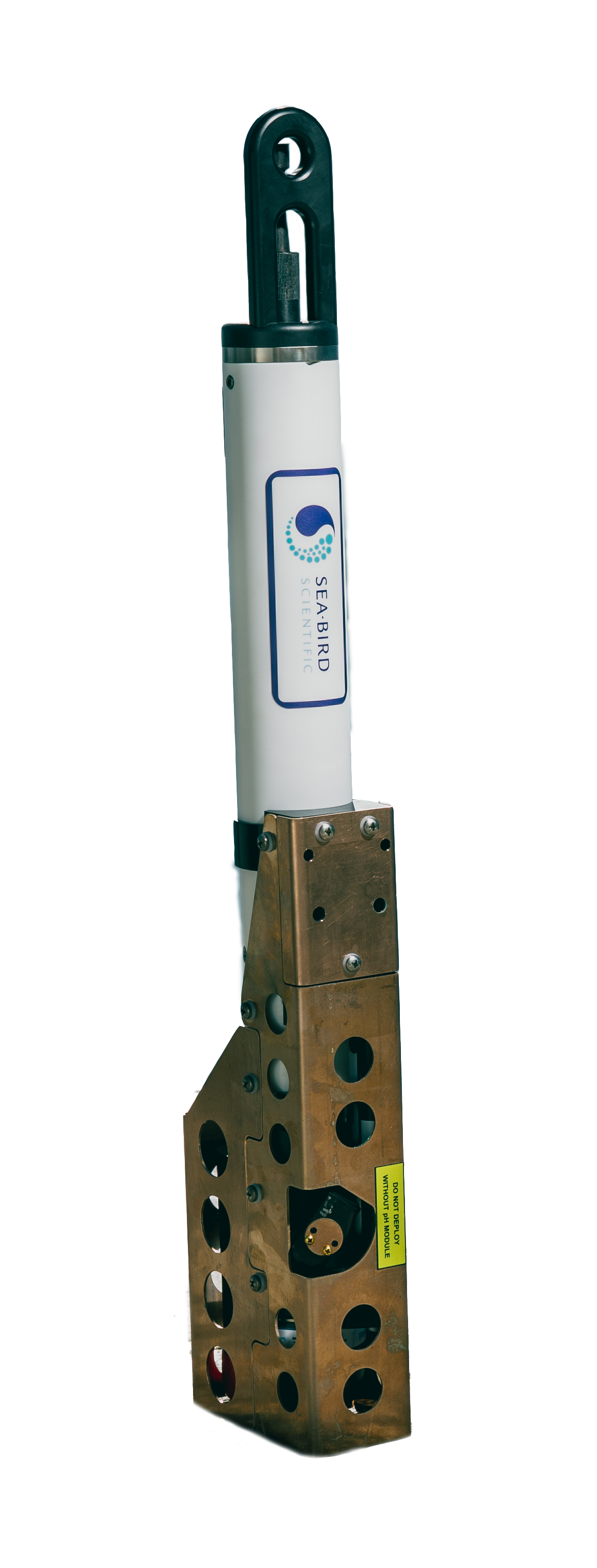 The HydroCAT-EP V2, Sea-Bird Scientific’s newest multiparameter CTD for moored applications, was chosen as the solution for this study due to its unique pumped flow technology, high data accuracy, robustness, and autonomous capability. When asked why she felt the HydroCAT-EP V2 was the right choice, Dr. Kealoha told us:
“We needed an instrument that was robust, sturdy, and comprehensive – something that could measure a suite of parameters related to coral reef stressors.“
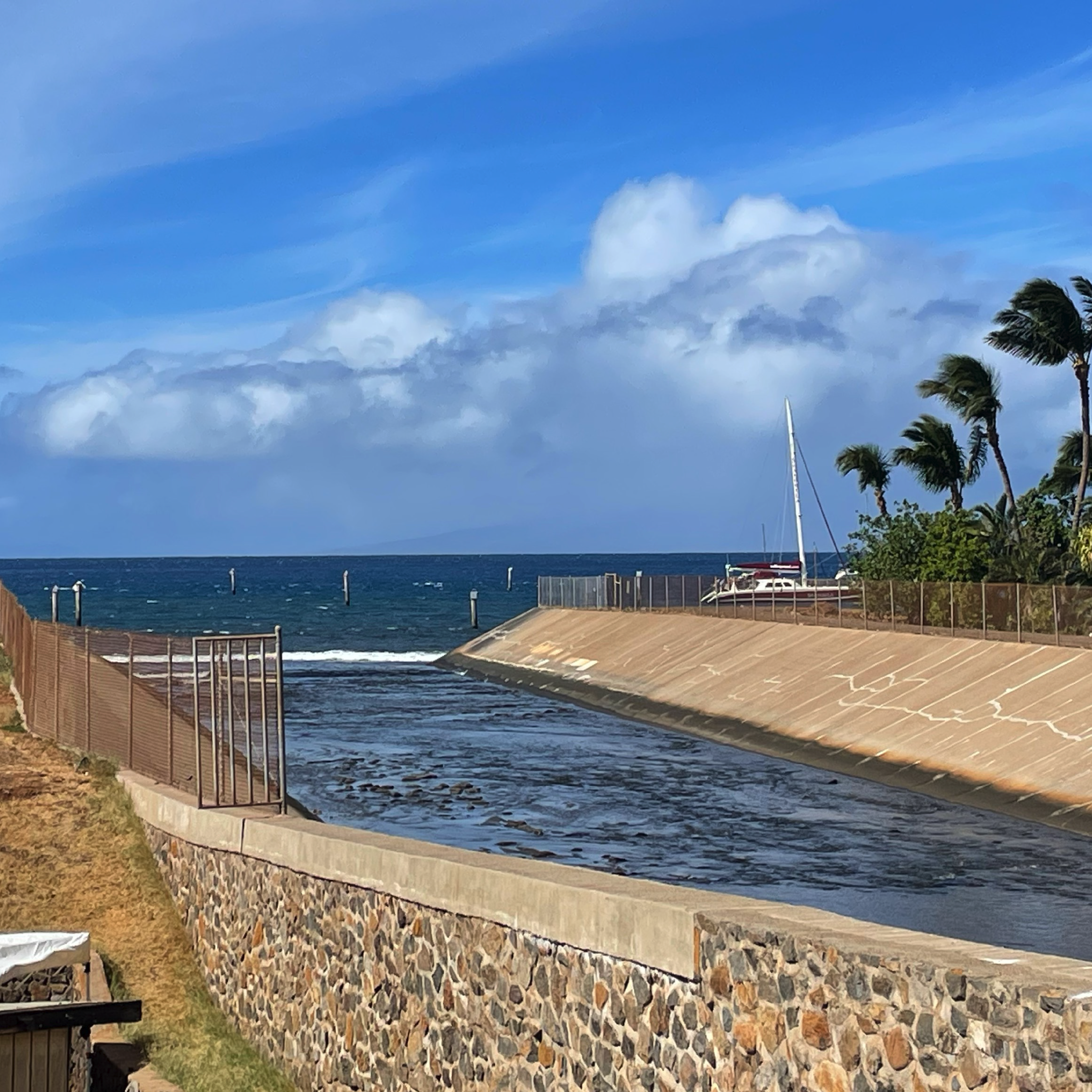
A HydroCAT-EP V2 CTD was deployed at the Mala boat ramp that sits at the outflow of the Kahoma Stream in the heart of Lahaina. The Kahoma stream runs down the western flank of the Puʻu Kukui Mountain, collecting water from across the water shed and ending at Lahaina Harbor.
Below, you can see a rough estimate of where the HydroCAT-EP V2 was deployed:
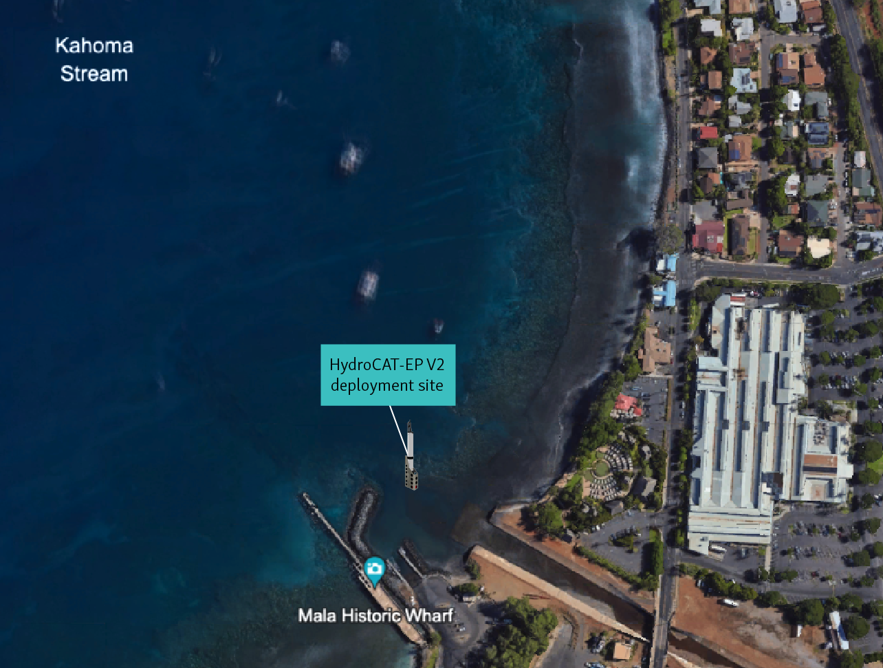
HydroCAT-EP V2 deployment site at Mala Wharf
Deployment Overview
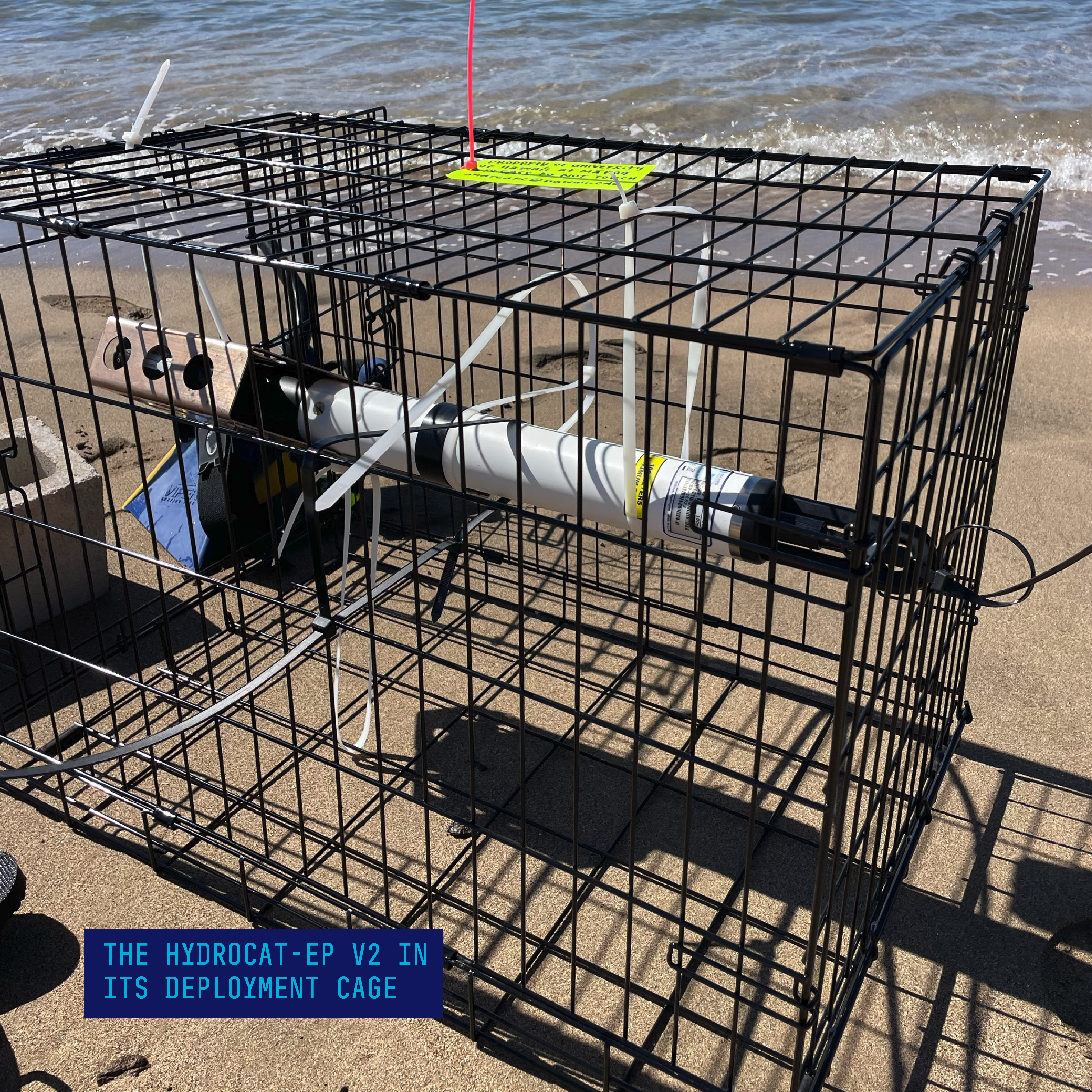
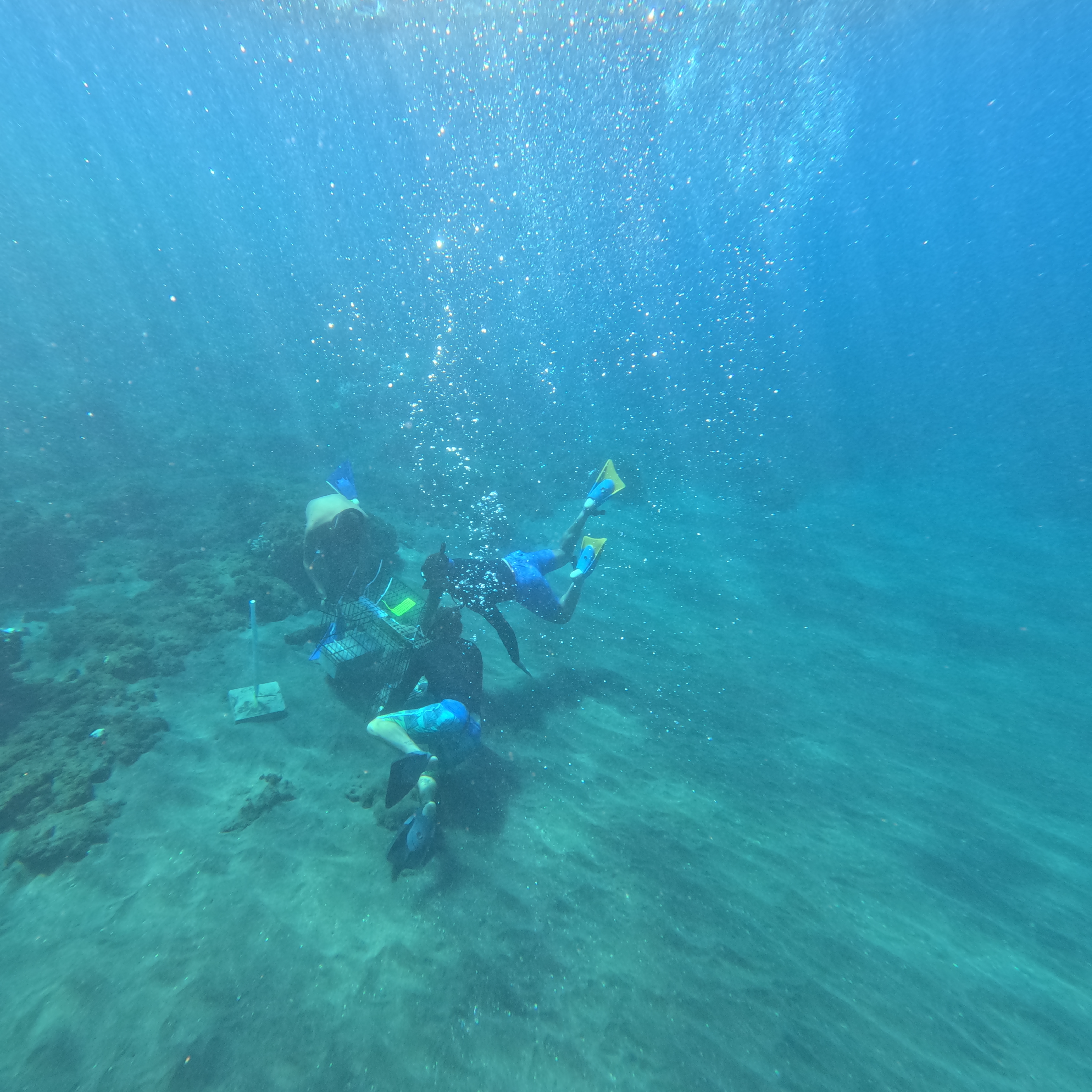
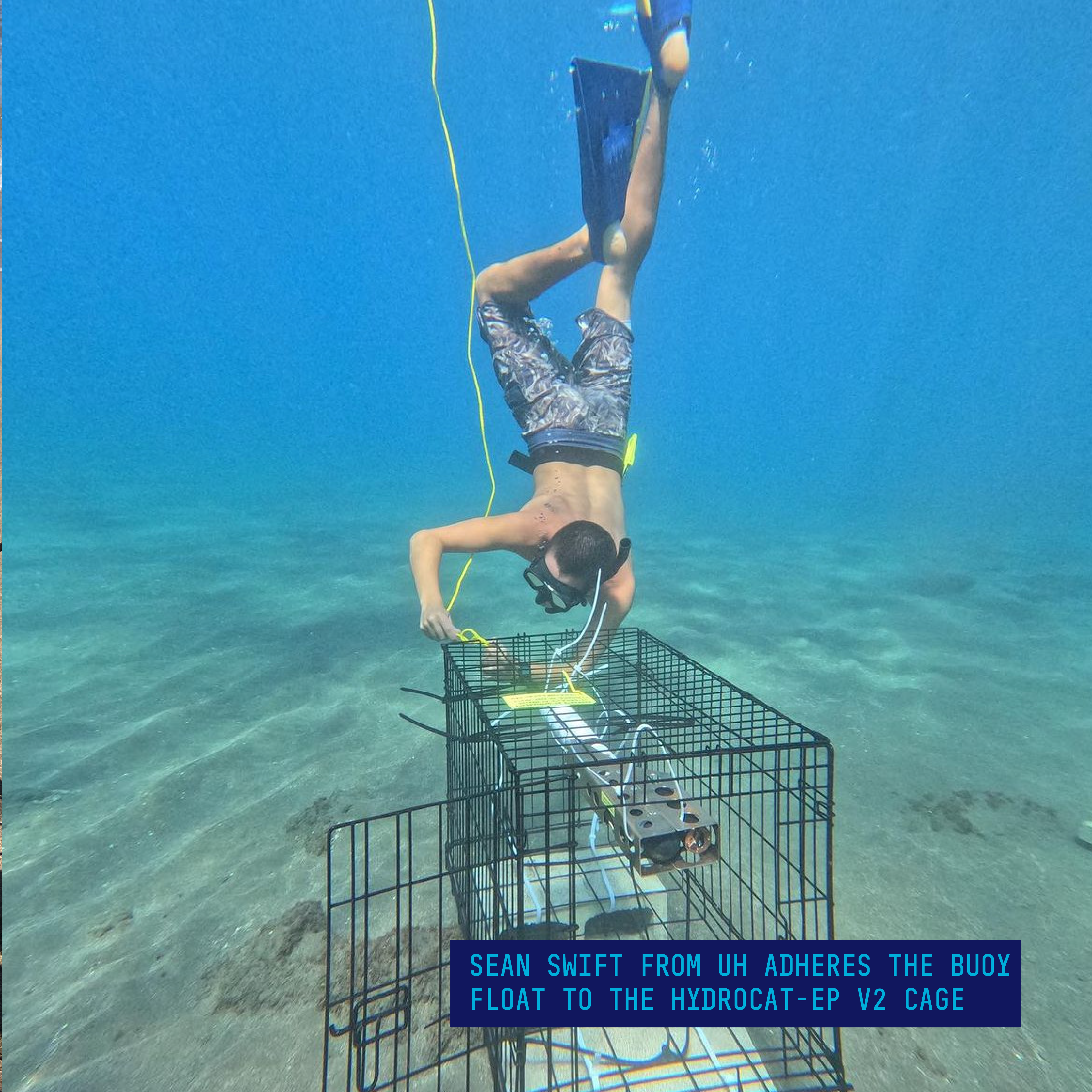
The HydroCAT-EP V2 was deployed on November 12th of 2023, approximately 14 weeks following the Lahaina wildfire. Given that this site regularly experiences large debris deposits such as tree trunks and branches carried down by the stream, the instrument was deployed in a cage to prevent physical damage. The cage was bound to the top of two cement blocks for stability, as well as to prevent interference from debris. A surface buoy marker was also attached to the cage to locate the system from above water.
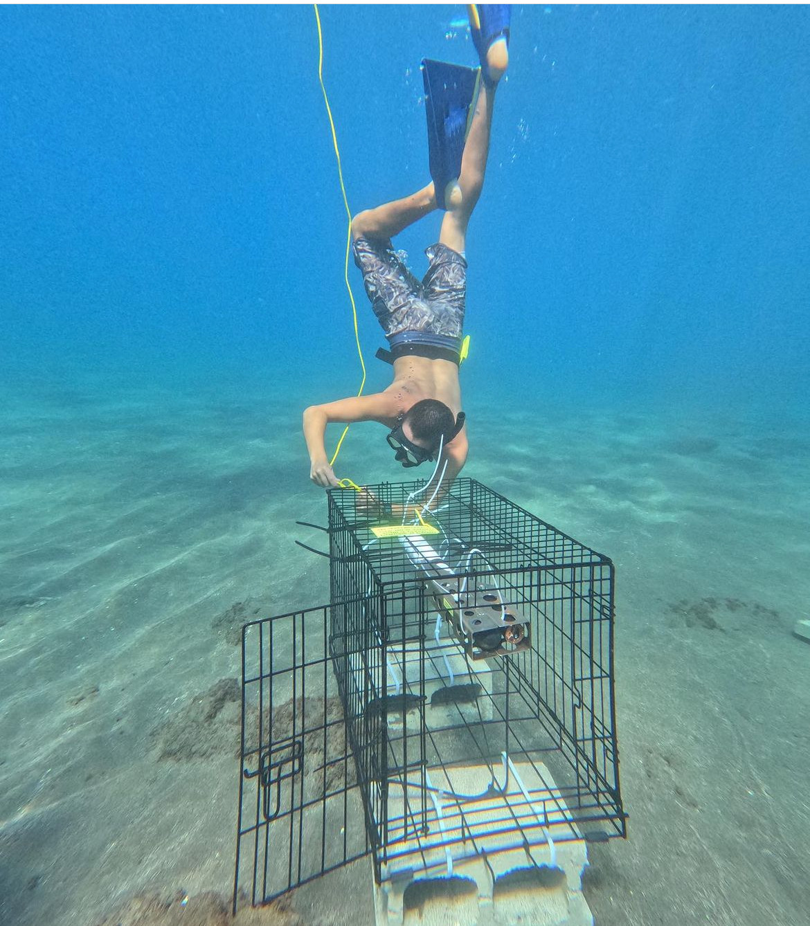
Sean Swift from UH adheres the buoy float to the HydroCAT-EP V2 cage.
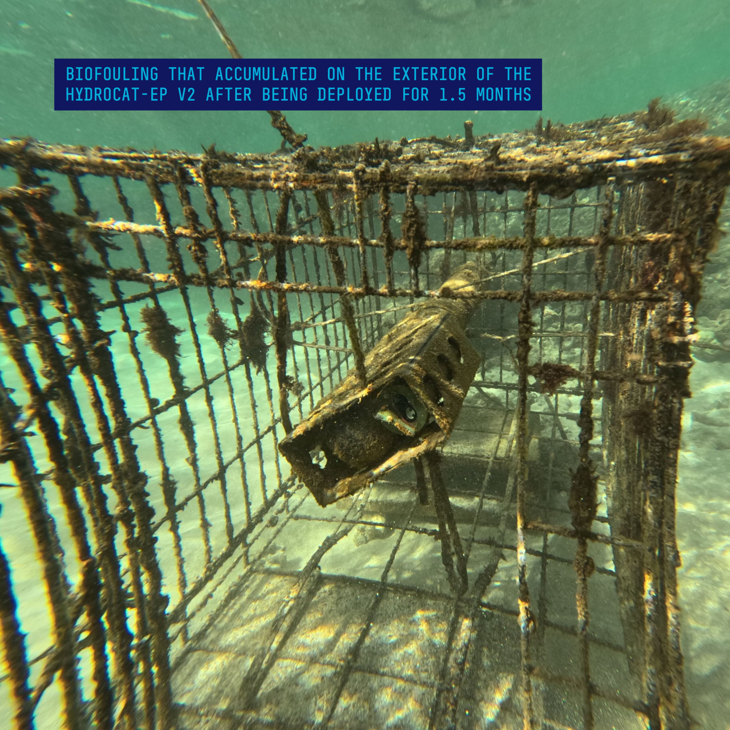
The HydroCAT-EP V2 remained deployed underwater for approximately 3 months, sampling each parameter every 20 minutes, resulting in 5825 total measurements per parameter or 40,775 measurements total. In biologically rich environments, it is typical for biofouling to develop within this timeframe. Given Hawai’i’s and specifically, Maui’s notoriously biodiverse and ecologically active coastlines, substantial growth can be seen in the below photo of the HydroCAT-EP V2, which was taken roughly 1.5 months into the deployment. While significant biofouling occurred on the outside of the instrument, the unique pumped flow path of the HydroCAT-EP V2 protects the temperature, conductivity, oxygen, and pH sensing elements from growth and damage for long term deployments under harsh conditions. Furthermore, the specialized pumped flow path of the HydroCAT-EP V2 ensures accurate measurements of each parameter and reduces errors, mitigating the risk of data uncertainty between sensors.
Biofouling that accumulated on the exterior of the HydroCAT-EP V2 after being deployed for 1.5 months
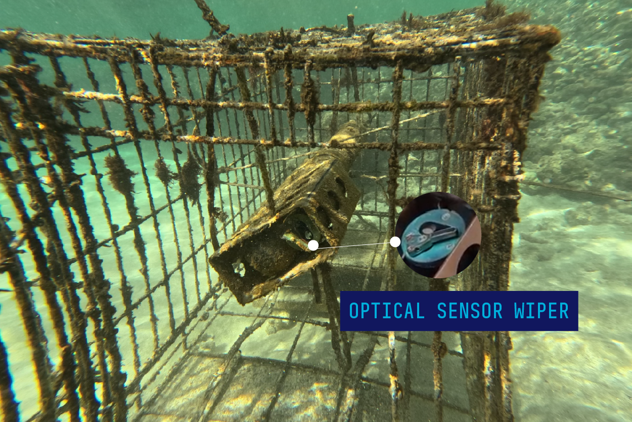
In addition to the pumped flow path, the exposed optics sensor for chlorophyll and turbidity has an integrated copper face plate and wiper that cleared the sensing window at every sample internal, preventing any growth or build up.
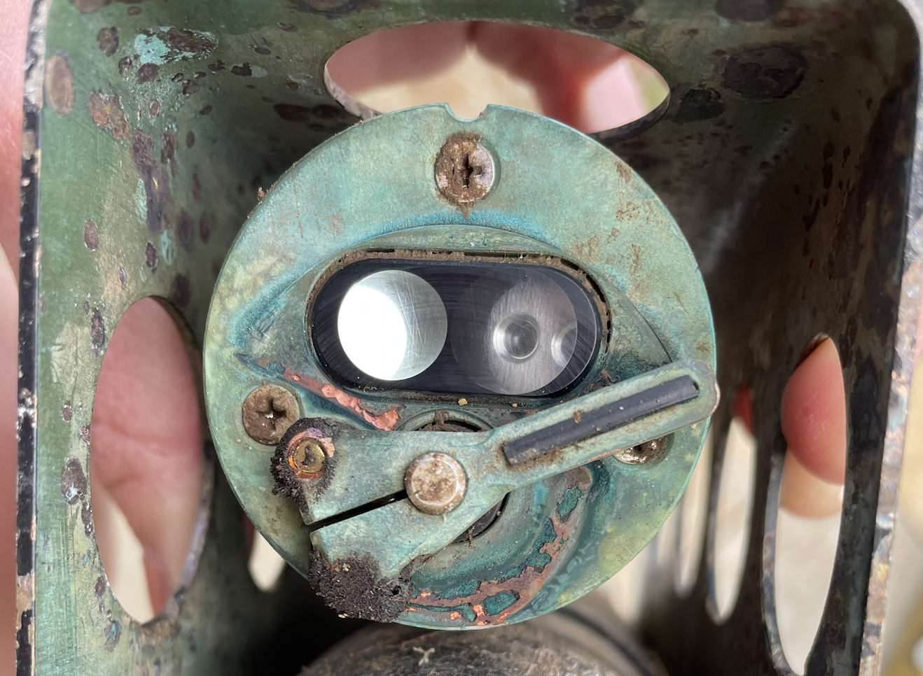
HydroCAT-EP V2 optical sensor window and wiper
At the end of the three-month marker, on February 1st, 2023, Dr. Kealoha successfully executed the retrieval effort of the HydroCAT-EP V2 with support from Sea-Bird Scientific and University of Hawai’i Maui College. After months of hoping, the team was pleased to pull a plethora of data from the instrument, which led to some crucial findings. Natalie Zielinski, Product Manager at Sea-Bird Scientific, who aided in both the deployment and recovery of the HydroCAT-EP V2, highlights the value of such a partnership with instrument users: 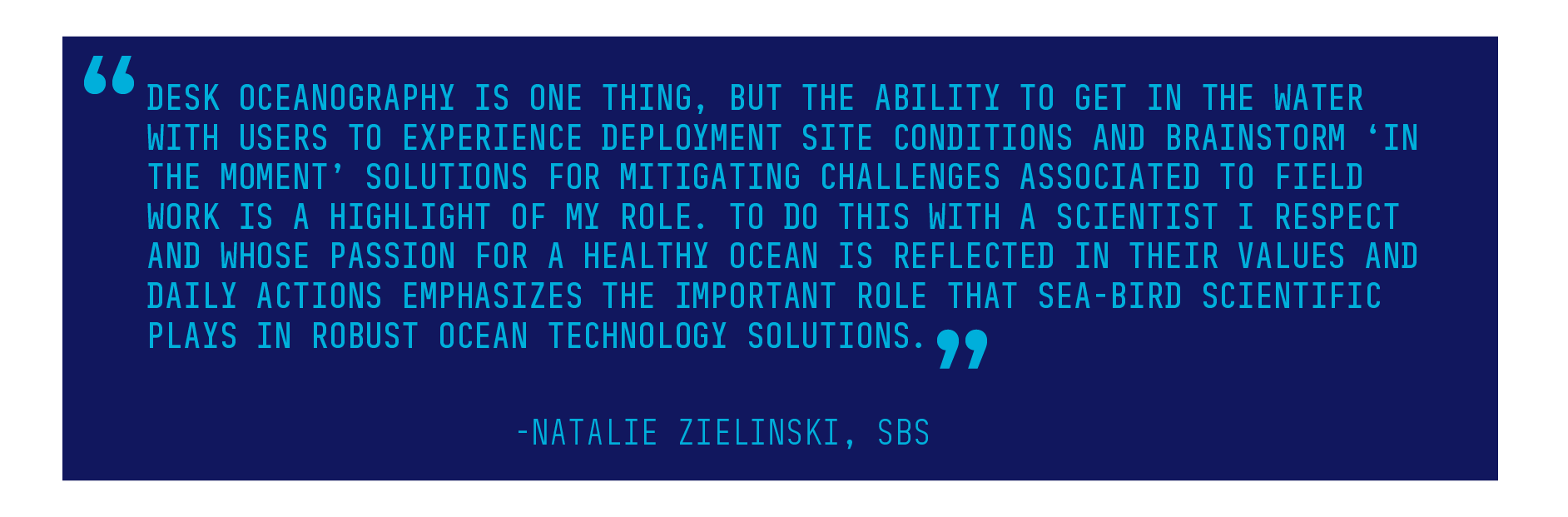
Results & Findings
The time series provided by the HydroCAT-EP V2 offers critical insights to drivers of ecosystem dynamics in Mala Wharf. Left for roughly 3 months completely undisturbed, the continuous data set captured baseline ranges of ‘normal’ conditions in the region as well as events of salinity changes due to influxes of fresh water, correlated high turbidity events, blooms of chlorophyll, and oxygen dynamics driven by diurnal cycles.
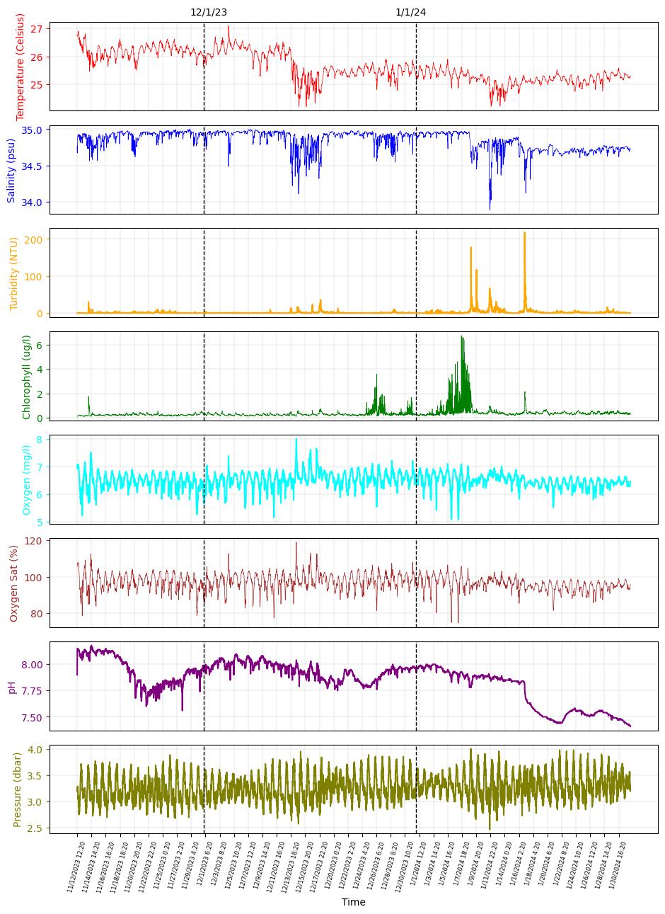
Figure 1: Full time series collected with the HydroCAT-EP V2. The two vertical lines correspond (a) December 1st and (b) January 1st.
The instrument recorded high frequency variations in both temperature and salinity as well as three short term events with decreases in both parameters associated with freshwater input during major storm events. Chlorophyll and turbidity display two major peaks during January that correlate visually with each other. Dissolved oxygen concentrations and oxygen saturation at this site are mainly driven by the diurnal-based tidal cycle as observed in the pressure record and seem unaffected by the short-term events.
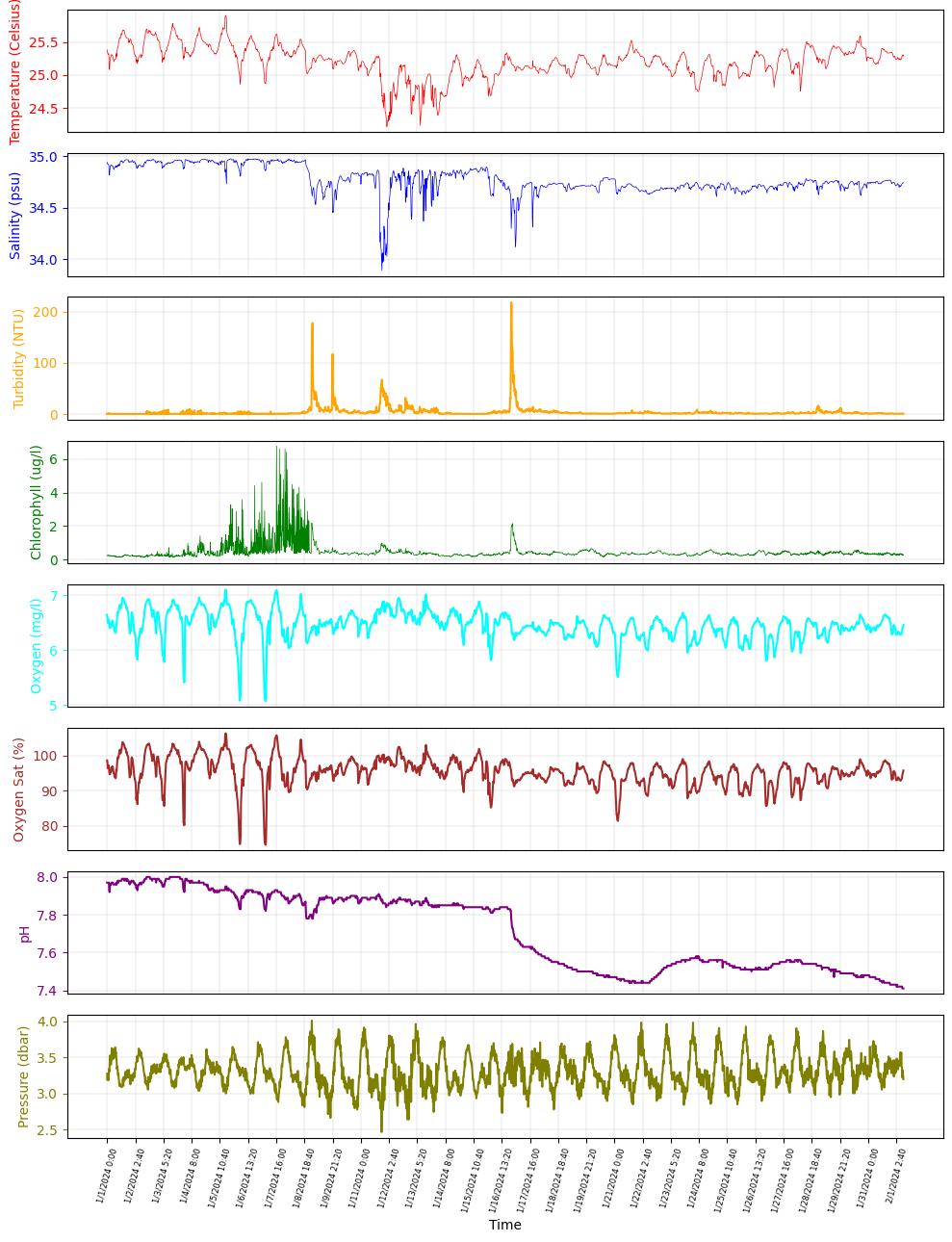
Figure 2: HydroCAT-EP V2 time series zoomed in for the month of January 2024.
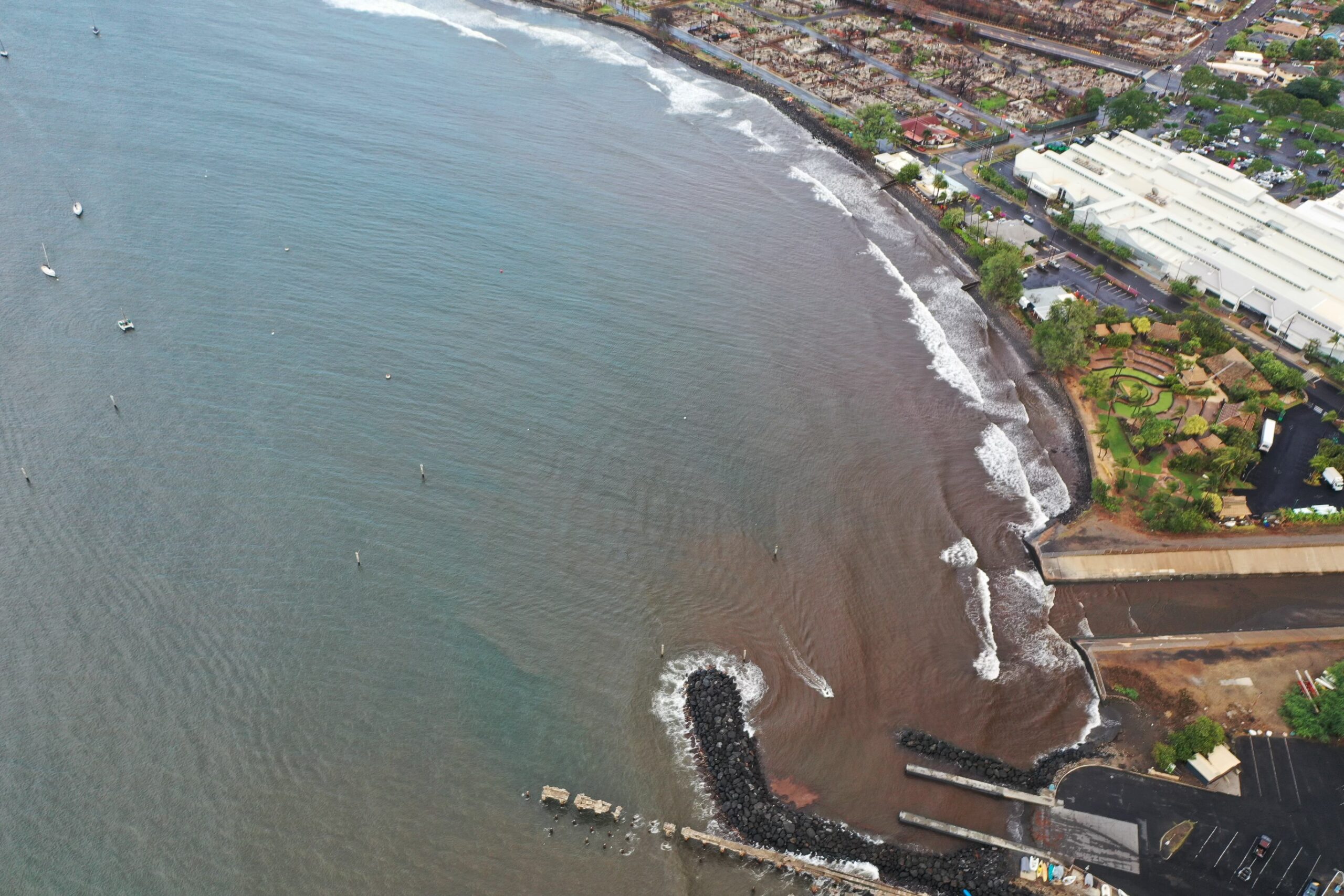
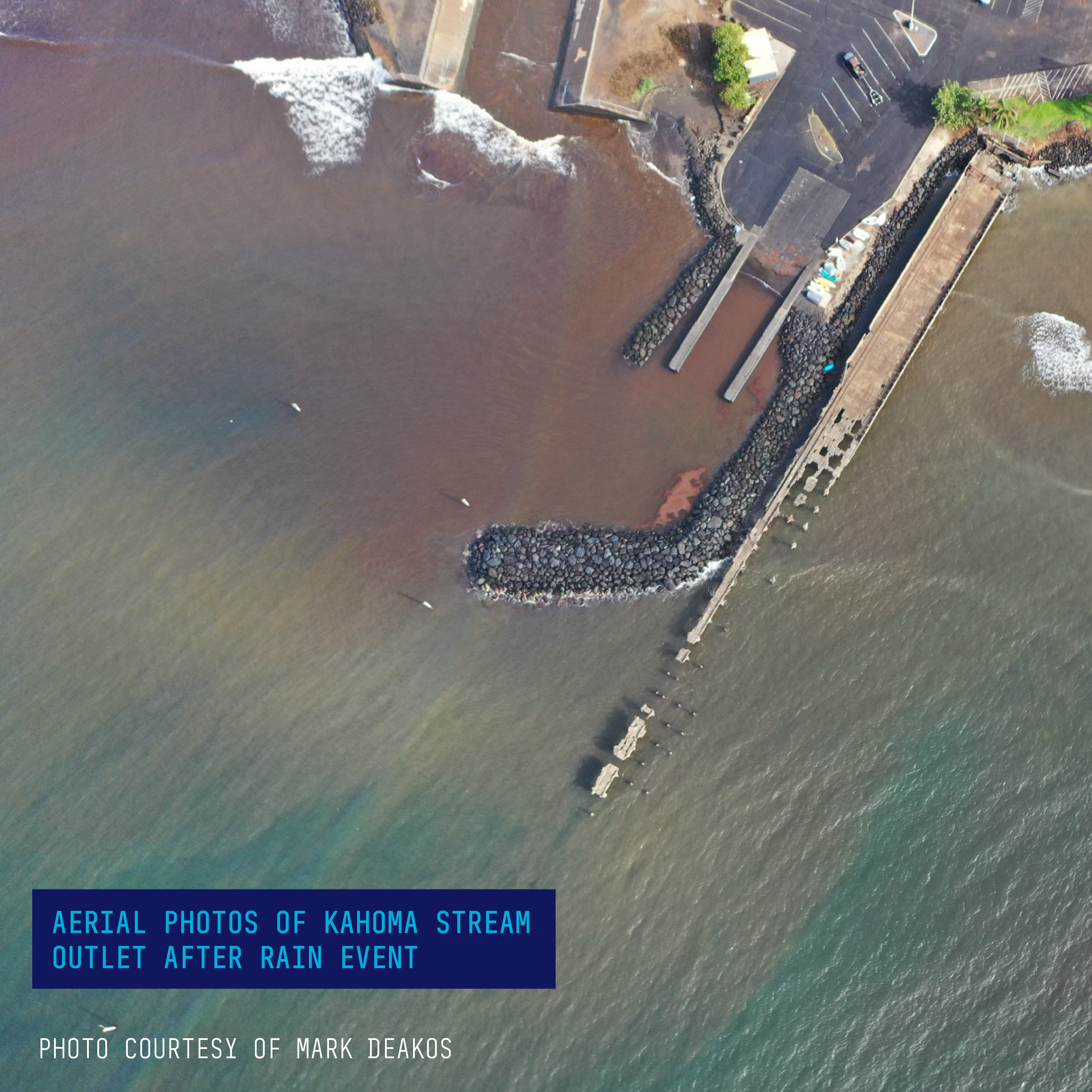
Figure 3: Aerial photos of Kahoma Stream outlet after rain event. Photo courtesy of Mark Deakos
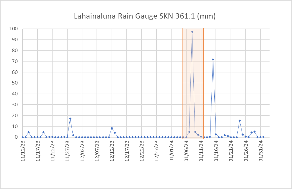
Figure 4: Daily rain totals from Lahainaluna rain gauge. Major winter storm on January 8th highlighted in orange.
Turbidity is well correlated with events of rainwater influx to the region, suggesting that debris, suspended sediment, and other minerals are regularly deposited into the coastal ocean. When combined with wet-chemistry measurements of chlorophyll-a and pH regularly collected as part of the study, a detailed understanding of biogeochemical dynamics can be obtained.
What These Findings Mean for the Future of Water Quality Monitoring on Maui
From this research, Dr. Kealoha and her team are still trying to better understand the connection between the short-term mild to moderate hypoxia events observed in the local coral reefs along the western coast of Maui to storm and runoff events. In the future, Dr. Kealoha is specifically interested in redeploying oxygen sensors near coral reefs over a longer period to determine if urban runoff and other anthropogenic influences such as treated waste water can in some cases cause hypoxia and acidification events in coral reefs. Furthermore, Dr. Kealoha emphasizes the need to not look at one parameter or measurement in a vacuum, and to focus on the implications of a stressor on an entire ecosystem.
“It’s not enough to just identify a stressor – but how do we quantify the impact of that stressor on reef health and persistence.”
One key component to the success of this study were the parties involved, and the speed in which they agreed to participate and work out a solution. The necessity for holistic understanding of the implications from the Lahaina wildfire calls upon non-profit, institutional, and private sectors to all work collaboratively to deploy solutions that can give us the full picture. When these stakeholders come together to focus on the value and insight that this type of research provides, it becomes evident that partnering is the best solution to ensure we understand both the ecological impacts as well as anthropological impacts on our oceans. This network of partnerships provides the building blocks we need to continue to implement a successful rapid response to ecological disasters such as the Lahaina wildfire. 
Acknowledgements
Public rain gauge data at Lahainaluna was provided by the Hawai’i Climate Data Portal, which is supported by the National Science Foundation OIA #2149133 and Hawaii EPSCoR- RII Track-1: Change Hawaii: Harnessing the Data Revolution for Island Resilience. Data can be accessed here: Hawaiʻi Climate Data Portal (hawaii.edu) We also want to thank local law enforcement and agencies for their continued dedication to the health and safety of Lahaina residents and visitors.